Izumo Project-River discharge pattern extruction at the time of flooding by using oblique aerial photography -
In case of river discharge investigation by remote sensing, it is desirable to have the entire bay shown in a single image.
Photographs must therefore be taken from a high altitude, but this is often extremely difficult due to the fact that at times of flooding the sky is often covered by low cloud. This study was called "Izumo Project", and it was conducted in Taisha Bay, Shimane prefecture, Japan.
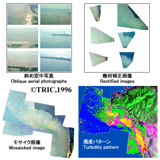
Photographs were taken from the altitude of about 100- 500m with two nonmetric cameras. Concurrently with the aerial photography, turbidity of water was measured at 15points in the bay. Projection transformation was used in the orthographic projection. After projection transformation, orthographic images could be obtained by nearest neighbor resampling.
In order to display the entire bay in a single image, the images must be mosaicked.In this study, six photographs were mosaicked. A multiple regression analysis was used to determine the relationship between the R, G and B brightness of each pixel and the turbidity.
The resulting turbidity pattern in the bay were outputted as a color coded image using level slicing technique. As a result, a clear pattern was obtained of the turbid waters entering the bay from the rivers.