- Environmental change of the Mekong - A flood of the Mekon delta
The Mekong River basin has an extensive area reaching approx.4,600km in total length and 800,000Km2 in area. Since the natural environments between the north region and the south region are considerably different, the human activities and the historical changes of every corner in the basin are various.
The Mekong Delta is a huge delta plain having an expanse of approx.50,000km2. The apex of the delta is near Phnom Penh which is the capital of Cambodia and the average height approx.2m.
There are many ancient remains such as O'ceo, Angkor Wat, etc.considering to be very important to study the ancient environments of the Southeast Asia.
In this area, the Mekong rises annually by the arrival of the monsoon and the snowmelt from the mountain range of the upper reaches toward May-June and the flood occurs toward September-October as a peak.
The figure below are the satellite image which caught the difference between the dry season and the wet season in the Mekong delta, and it shows that the northern region from Kompong Cham to Long Xuyen is flooded in the wet season. And people there seem to have been leading their life as adapting to a natural flow and change of the Mekong since ancient times.
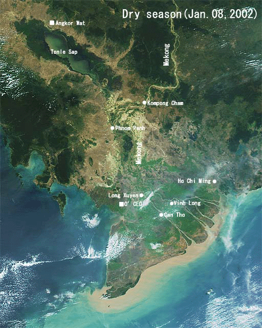
The flood of the Mekong delta
(Comparison between the dry season and the wet season in 2002)
Image Processing:Tokai University research & Information Center (TRIC)
Data:NASA GDAAC MODIS support team
Reference: Annual Report of Ancient Environments Study from Space (AESTO,2003)