-WORLD HERITAGE SERIES 1-Lines and Geoglyphs of NAZCA seen from space
It is said that the Lines and geoglyphs of Nazca in Peru of South America which is known as a world heritage was discovered by the aerial survey carried out in 1930's.
Around this area, there are a lot of drawings made of long straight lines of several
kilometers to more than ten kilometers in length as well as large geometric shapes such as figues of creatures, plants,etc. having the sizes of several ten meters to more than a
hundred meters of which they are meaningless at ground level, however no one knows the
meaning of them.
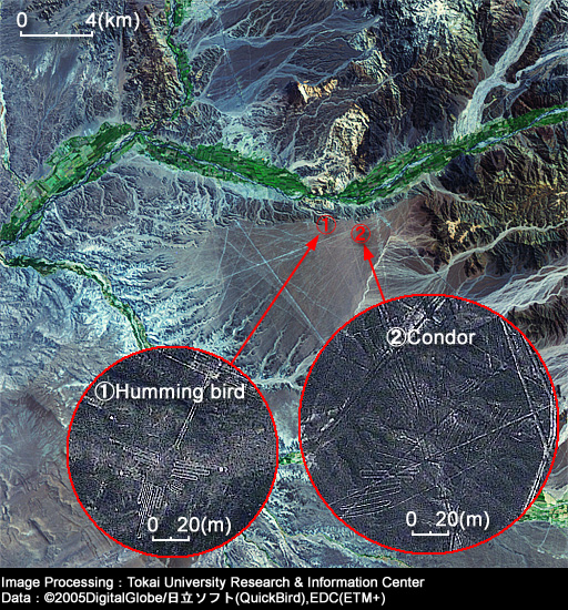
This image shows the site of Nazca by the use of both LANDSAT ETM+ with the ground
resolution of approx.30m (CH6=approx.60m, CH8=approx.15m) and QuickBird with the ground
resolution of 60cm (inside of red circles).Earth observation satelltes data are helpful to detect these archaeological sites too.
Lines and geoglyphs of NAZCA
(LANDSAT image:2000/04/26,QuickBird
image:2002/09/16)