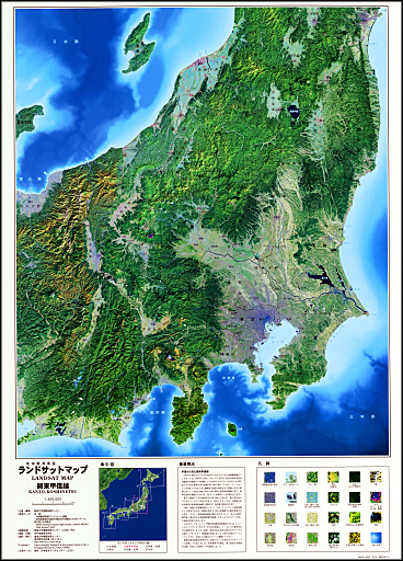
NEW LANDSAT MAP OF JAPAN-Kanto Koshinestu region in Japan seen form space-
TRIC newly updated Landsat map in Kanto Koshiestu region. Advanced Earth Observing Satellite Landsat Keeps catching the earth where we live from the polar orbit in the sky of about 705km on the ground for 30 years or more.
This image has synthesized the color like recognizing land coating information easily such as forest on the ground, the agriculture meadow, such as cities.
To do to compose Landsat map Kanto Koshinetsu region, we collected only the data of 11 scenes, and did the mosaic processing.As a result, large area Landsat map that covered east and west 400Km south north 500km was completed.
The depth pattern is converted into a light blue gradation and the sea area has been synthesized.
NEW LANDSAT MAP OF JAPAN-Kanto Koshinestu region
Scale:1:500,000
Data of the ocean floor:Hydrographic Oceanographic Department,Japan Coast Guard "Information and Data Service"
Image processing:TRIC