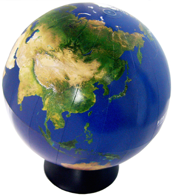
New version of the satellite globe series made of MODIS-The globe of MODIS image-
This globe is the latest version of the satellite globe series which has been developped by TRIC since 1987.To produce this beautiful globe, MODIS data were newly used instead of NOAA/AVHRR.
This size of the globe is 12.5 cm in daimater and the scale is apporoximately 1 to 100 thousands, and it shows a various surface features of the earth such as forests ,deserts, etc. The image quality of this new globe is better than previous one because the ground resolution is improved.
MODIS (Moderate Resolution Imaging Spectroradiometer) is an optical sensor aboard the eart observation satellite of Terra (EOS AM) and Aqua (EOS PM) lanched by NASA.
Terra MODIS and Aqua MODIS are viewing the entire Earth's surface every 1 to 2 days, acquiring data in 36 spectral bands with a swath of approx 2330km. These data will improve to understand global dynamics and processes occurring on the land, in the oceans, and in the lower atmosphere.
